- Simon Drake
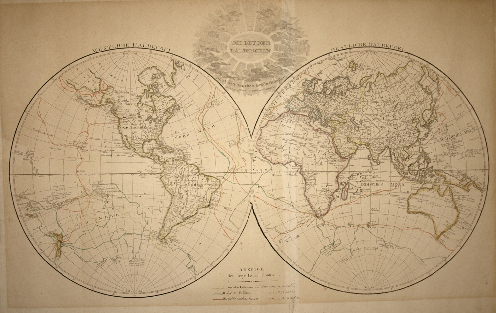 |
Both HemispheresDate: Circa 1800 (1795 - 1820)Language: German Description: Both Hemispheres (West and East) displaying the explorations of Captain Cook. Engraver: Franz von P. Reißer Publisher: Tranquillo Mollo and Company Size: 79cm x 52cm 'Die beyden Halbkugeln' Die beyden Halbkugeln (westliche Halbkugel, oestliche Halbkugel) samt den neuesten Entdeckungen -- Anzeige der drey Reisen Cooks / Franz von P. Reißer [Stecher] Map Maker: F. Reißer Verlag: T. Mollo und Compagnie (Tranquillo Mollo and Company), Wien |
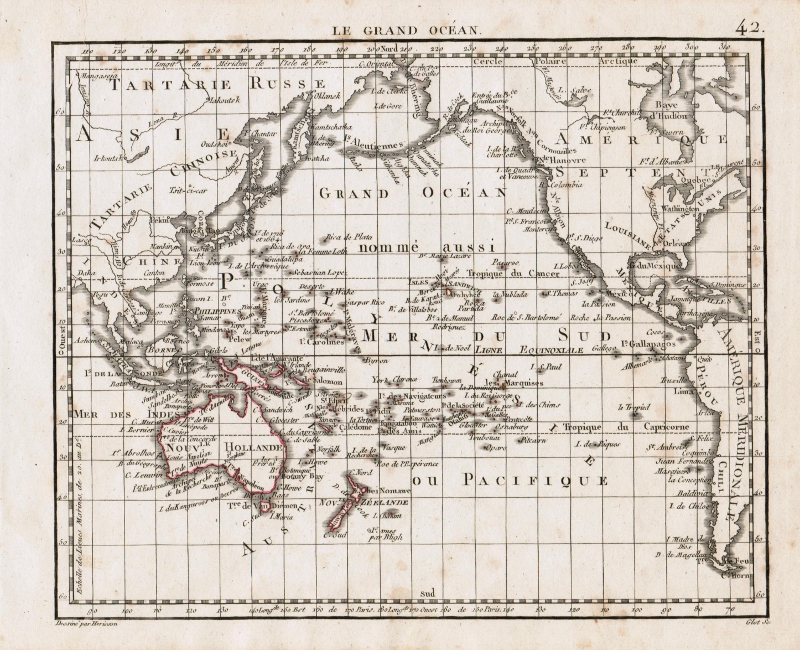 |
Le Grande Ocean circa 1806Date: 1806Language: French Description: The Pacific Ocean from a French perspective, e.g. At the time they thought it would make a nice addition to Bonaparte's European conquests? Map Maker: Eustache Herisson (b. 1759) and C. B Glot Size: 25cm x 20cm |
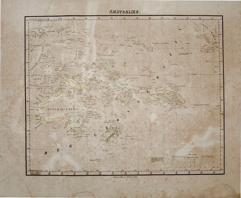 |
Australia and Pacific 1844Date: 1844Language: German Description: Overview of the Pacific, including Australia. From: Sohr's Hand-Atlas 1844 Publisher: Carl Flemming, Glogau (Germany) Size: 35cm x 30cm |
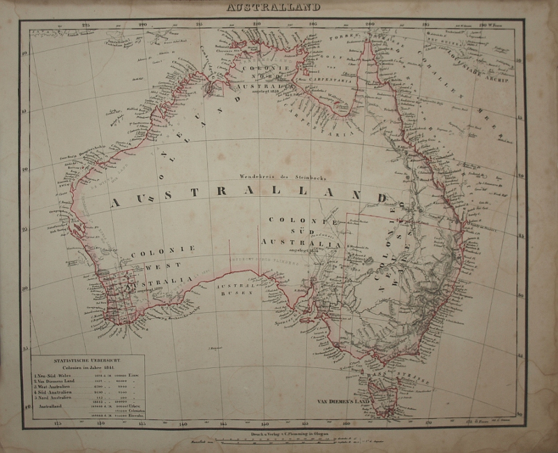 |
Australland 1844Date: 1844Language: German Description: Shows the progress of early discoveries and state borders. Prominent are the great white swathes of unexplored lands in Australia. From: Sohr's Hand-Atlas 1844 Publisher: Carl Flemming, Glogau (Germany) Size: 35cm x 30cm |
 |
Australia 1846Date: 1846Description: A finely detailed map of Australia. Map Maker: W. Hughes, 1846 Publisher: A & C Black Medium: Steel Engraving Size: 27cm x 22.4cm |
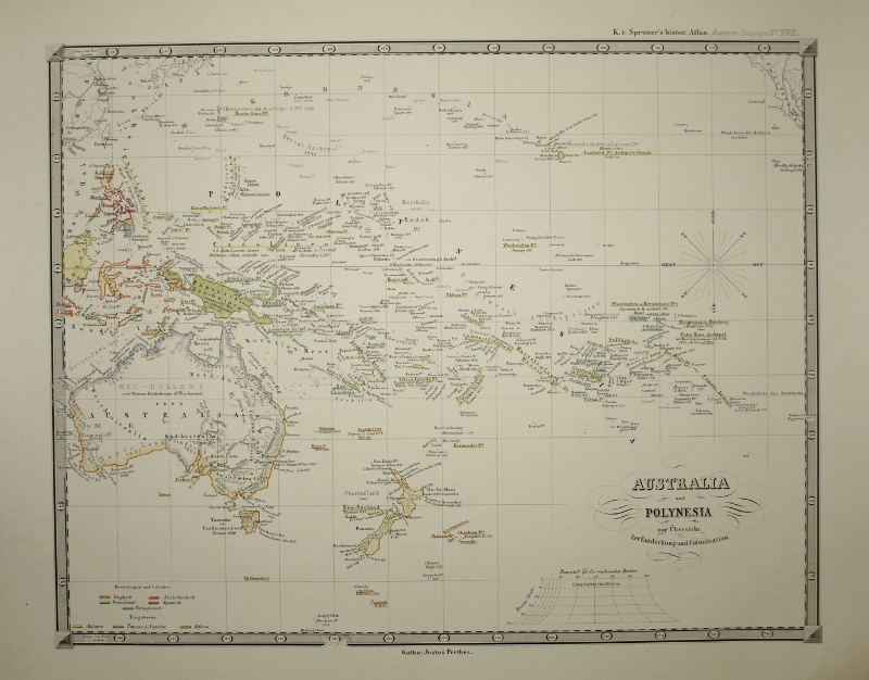 |
Australia and Polynesia 1855Date: Circa 1855Language: German Description: Shows the different Colonies and years they were discovered. Also reflects a time when Germany had colonies in what is now northern Papua New Guinea. From: K.v. Spruner's Historic Atlas Publisher: Justus Perthes, Gotha Size: 45cm x 37cm |
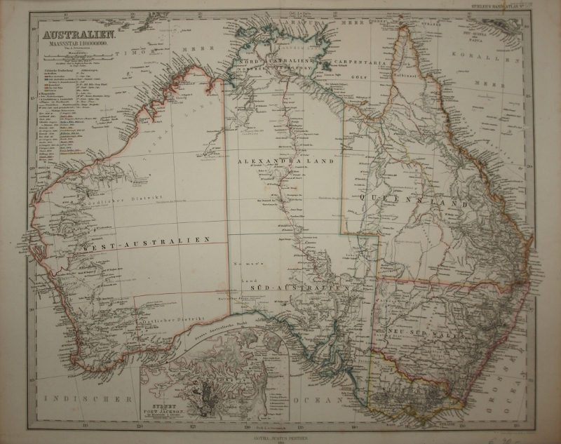 |
Australien 1866Date: 1866Language: German Description: Shows the routes and discoveries by prominent explorers up to 1866. Engravers: H. Alt and Schroder Publisher: Justus Perthes, Gotha Size: 45cm x 37cm |
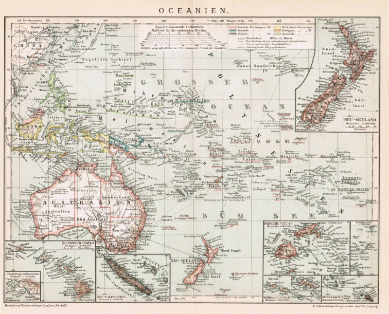 |
Oceanien 1896Date: 1896Language: German Description: The Pacific, vast and mostly explored, end of the 19th Century. Map Maker: F.A. Brockhaus, Anstalt, Leipzig, 1896 Size: 29cm x 23cm |
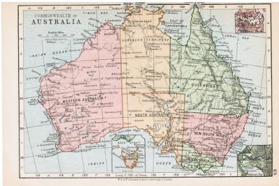 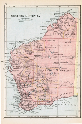 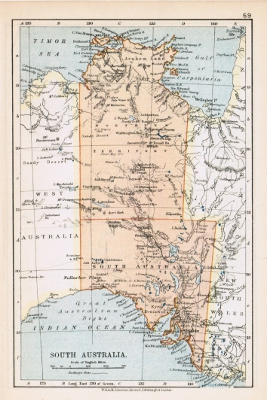 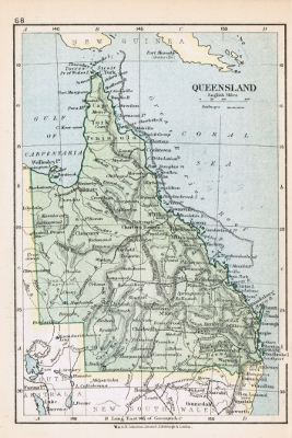 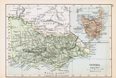  |
Australia and StatesLanguage: EnglishDescription: Standard mini-atlas maps of Australia and states. Date: Circa 1900 Purchase: 10 pound, London, 2010 Map Maker: W & A.K Johnston Limited, Edinburgh & London Sizes: 18cm x 12cm / 12cm x 18cm |